Published On:
March 2, 2026
Updated On:
March 2, 2026
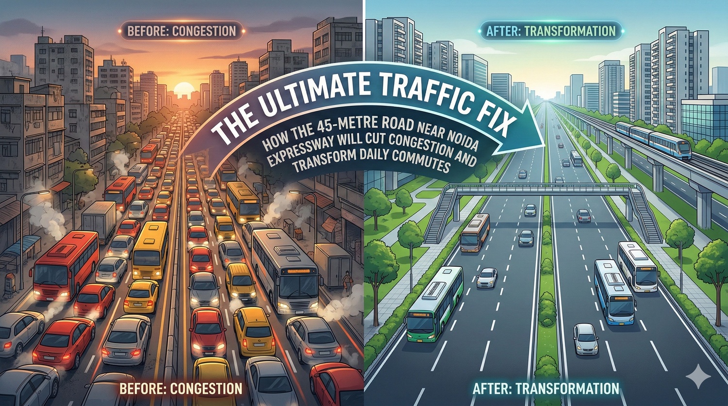
Noida is fast-tracking the completion of a 45-metre wide parallel arterial road to bypass the heavily congested Noida-Greater Noida Expressway. By bridging three critical land gaps, this route will keep local traffic off the main highway, easing daily commutes and significantly boosting real estate value in adjoining residential sectors.
If you have driven through the National Capital Region recently, you know that the Noida-Greater Noida Expressway is the undisputed backbone of local infrastructure. It is the high-speed corridor that dictates the pace of the city's economic and residential heartbeat. However, for the hundreds of thousands of daily commuters, logistics operators, and local families who rely on this 25-kilometer stretch, the daily drive has become increasingly unpredictable. What was originally designed as a seamless, high-velocity highway to connect industrial suburbs has morphed into a highly congested bottleneck during peak hours.
The city is growing at a breakneck pace, and the infrastructure is under immense pressure to keep up. But relief is finally on the horizon, and it isn't coming in the form of a massive, decades-long mega-project. Instead, the local development authority is pivoting to a highly practical, immediate solution: completing a 45-metre wide arterial road that runs completely parallel to the main expressway. This strategic local corridor is set to redefine how people move across the city, separating heavy, inter-city transit from everyday neighborhood traffic. Here is a deep dive into how this road will function, why it is so crucial right now, and what it means for the future of the region's real estate and mobility.
To understand the brilliance of the parallel road, we first have to look at why the main expressway is struggling so much. The Noida-Greater Noida Expressway is a massive six-lane marvel that currently handles a chaotic, unregulated mix of traffic. On any given morning, you will find heavy commercial trucks, inter-state buses, and fast-moving corporate commuters sharing the tarmac with local residents who are just trying to drop their kids off at a nearby school or run to the grocery store.
This unhealthy mix of long-haul and short-haul traffic is the absolute root cause of the daily gridlock. Local residents from rapidly developing sectors along the corridor currently have no choice but to merge onto the high-speed expressway, even if they only need to travel a few hundred meters down the line. Every time local traffic merges onto the highway and then exits a moment later, it creates a severe ripple effect of braking and slowing down, dropping the overall speed of the entire corridor and leading to miles of tailbacks.
Furthermore, the urgency to fix this specific issue has never been higher. With the massive Noida International Airport at Jewar gearing up for operations, the volume of vehicles entering the city from the DND Flyway, the Chilla border, and Kalindi Kunj is expected to skyrocket. The expressway simply cannot handle the incoming international airport traffic if it remains clogged with local neighborhood commuters.
The solution has actually been hiding in plain sight. As part of the city's original master plan, urban designers included a 45-metre wide sector road running alongside the main expressway. This wasn't meant to be just a narrow, secondary alleyway; it is a highly robust piece of infrastructure featuring a six-lane central carriageway flanked by dedicated, paved service roads on both sides.
The core purpose of this arterial road is to act as a dedicated neighborhood network. If a resident in Sector 135 needs to visit a medical clinic in Sector 168, they shouldn't have to battle 100 km/h airport-bound traffic to get there. The 45-metre road allows them to travel parallel to the highway in a much safer, highly controlled environment. It is designed to link residential pockets, local commercial markets, educational institutions, and healthcare facilities seamlessly without ever touching the primary transit vein.
When fully operational, this road acts as a massive pressure release valve for the main expressway. It effectively segregates traffic by intent. Those looking to cross the city or head to other districts stay on the high-speed expressway, while those moving within their local ecosystem stay safely on the parallel arterial road.
If this parallel road is such a perfect solution, why are commuters still stuck in heavy traffic today? The frustrating reality is that while the vast majority of this beautiful six-lane arterial road is fully paved, painted, and ready to use, it is completely broken at three highly specific points.
Between Sectors 163 and 167, there are three missing stretches of land measuring exactly 74 metres, 75 metres, and 81.5 metres. On a map, these gaps look incredibly minuscule. But on the ground, they act as an absolute barrier. Because these three small patches of dirt interrupt the asphalt, the road cannot function as a continuous end-to-end corridor.
As a result, the parallel road is currently nothing more than a series of frustrating dead ends. Residents living in premium neighborhoods across Sectors 150, 151, 152, 153, 155, 163, 167, 135, and 168 find themselves driving down a beautifully wide sector road, only to be abruptly forced to merge back onto the heavily congested main expressway just to bypass a 70-metre gap in the pavement. It defeats the entire architectural purpose of the local road network and violently forces thousands of cars onto the highway unnecessarily every single day.
The reason these three specific gaps exist comes down to highly complex, historical local land acquisition issues. The land required to connect these stretches—amounting to roughly 2.5 acres in total—is currently agricultural land owned by local farmers.
The landowners have understandably been holding out for specific compensation models, primarily demanding a land-for-land swap within the developed city limits rather than accepting standard financial payouts. For years, this bureaucratic standoff left the road incomplete. However, recognizing the sheer economic cost of the daily traffic jams and the looming pressure of the airport, the city's top authorities have now stepped in with an aggressive mandate to resolve this immediately.
High-level directives have been issued to the civil and land departments to actively sit down with the farmers and negotiate a fair, mutually beneficial resolution. The administration no longer views bridging these gaps as a minor road repair; it is being treated as a critical infrastructure emergency. Once an agreement is reached and those few acres are acquired, paving those missing meters will take mere weeks, instantly unlocking the full, unhindered potential of a massive traffic corridor.
To fully grasp why finishing this 45-metre road is making top headlines across real estate and infrastructure circles, you have to look at the broader playbook of the region. For a long time, the city's "Plan A" to decongest the main highway was a highly ambitious project known as the Yamuna Pushta Expressway, or the Riverside Highway.
This proposed project was a massive 30-kilometer elevated corridor planned along the Yamuna river embankment, stretching from the Okhla Barrage all the way down to Sector 150. It was supposed to be the ultimate, high-capacity parallel mega-highway. However, building massive concrete structures along a highly sensitive river ecosystem is incredibly complicated.
The project recently hit a massive, perhaps insurmountable, roadblock. The irrigation department flatly refused to grant the mandatory no-objection certificate, raising severe red flags about the environmental impact. Their core concern is that heavy construction near the embankment could severely compromise the city's flood protection mechanisms, aggressively disrupt natural monsoon drainage channels, and weaken the structural integrity of the river levee.
With the riverside elevated highway firmly stalled in regulatory and environmental limbo, the city cannot afford to wait years for clearances while traffic grinds to a halt. The 45-metre parallel sector road is no longer just a local convenience; it has been officially elevated to the city's primary "Plan B." It is the most viable, immediate, and ecologically safe method to drastically divert traffic and save the region's mobility network from collapsing under its own weight.
Infrastructure is the ultimate driver of real estate value, and the completion of this parallel road is already sending strong positive signals through the property markets along the entire expressway corridor.
Sectors like 150, 135, and 168 have firmly established themselves as premium residential hubs featuring high-rise luxury societies, sprawling green spaces, and ultra-modern amenities. However, prospective buyers and long-term tenants have frequently cited the bottlenecked entry and exit points as a major lifestyle negative. Nobody wants to invest in a luxury apartment if it takes twenty minutes of high-stress driving just to navigate the highway interchange to get home.
By finalizing this uninterrupted local road network, the livability score of these micro-markets will shoot up drastically. A continuous 45-metre road means that local school buses won't be delayed by highway cargo traffic. Ambulances heading to nearby super-specialty hospitals will have a clear, dedicated, and fast-moving path. Daily runs to the grocery store, local gym, or the neighborhood mall will become entirely stress-free.
For property investors, this is a massive green flag. Seamless internal connectivity historically leads to significantly higher rental yields and highly robust capital appreciation. Commercial real estate in these sectors will also see a tangible boom. Local retail shops, cafes, and daily-need stores thrive when they are easily accessible by quiet neighborhood roads rather than intimidating, high-speed highways. Real estate developers are keenly watching the progress of these road links, knowing that a fully functional sector road network will make properties here infinitely more attractive to families and young corporate professionals.
When you pull back and look at the entire National Capital Region, the strategic value of this local road becomes undeniable. A city's road network is essentially its circulatory system, and right now, the main artery is experiencing a severe blockage.
Once the three gaps are filled and the 45-metre road is fully paved, the authorities will finally have a highly reliable, built-in diversion route. Currently, if there is a vehicle breakdown, a minor fender-bender, or essential road maintenance on the main expressway, the entire grid locks up for miles because there is quite literally nowhere else for the cars to go. The parallel road will serve as an immediate, high-capacity relief channel. Traffic can be easily diverted off the highway, smoothly routed through the sector road, and seamlessly merged back onto the expressway past the incident site.
Furthermore, as the city gears up for the massive influx of international travelers and logistics freight heading toward the new Jewar Airport, segregating local traffic is the only mathematical way to ensure the region remains globally competitive. Business travelers and international freight simply cannot be stuck in suburban traffic jams. The region's economic future relies on keeping that main corridor clear.
The aggressive push to complete the 45-metre road near the Noida Expressway perfectly illustrates a brilliant shift in modern urban planning. It shows that cities do not always need to build a brand new, multi-billion-dollar elevated mega-highway to solve a localized traffic crisis. Sometimes, the absolute most effective solution is simply finishing what was already started and ensuring that existing infrastructure connects logically and smoothly.
By aggressively resolving the land disputes and paving those final few meters of dirt, the city is about to unlock a dramatically improved quality of life for its residents. The days of treating a high-speed, inter-city expressway as a local neighborhood driveway are finally numbered. For the thousands of exhausted daily commuters, the completion of this parallel arterial route promises a safer, faster, and infinitely more peaceful journey home. The blueprint is clearly laid out, the administrative intent is locked in, and the ground reality is finally catching up to the vision of a truly seamless, world-class city.
