Published On:
December 1, 2025
Updated On:
December 1, 2025
Uttar Pradesh is implementing high-resolution satellite mapping with 15-30cm precision to digitize rural land records. The initiative aims to resolve property disputes across over one lakh villages by providing mobile access to exact boundaries via Gata/Khasra numbers, bypassing traditional revenue officers.
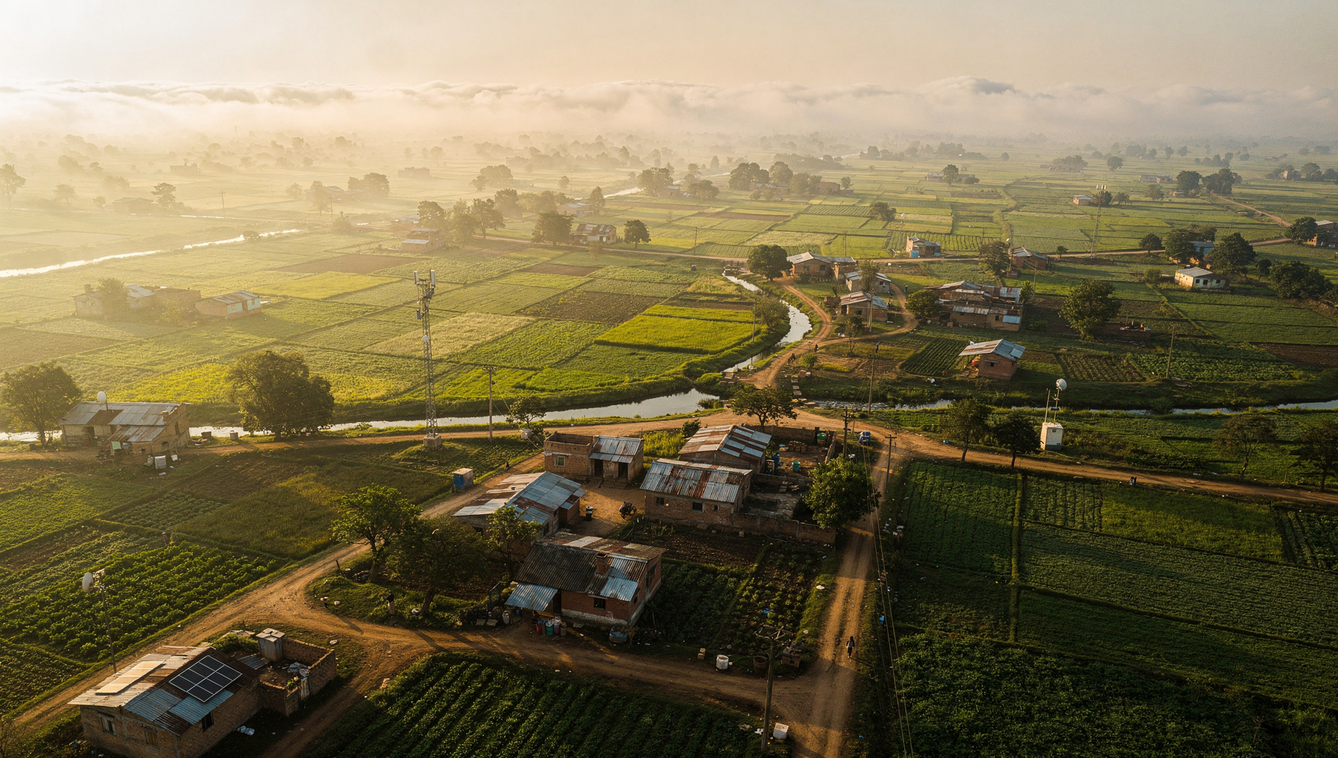
In a landmark move towards modernizing land governance, the Uttar Pradesh government has announced a massive initiative to digitize land records using advanced satellite technology. The primary objective of this ambitious project is to resolve chronic land disputes that plague rural areas across the state. By creating high-resolution digital maps of every farm and home, the government aims to provide indisputable evidence of property boundaries, directly accessible to citizens via their mobile phones.
The Power of High-Precision Satellite ImageryAccording to the Uttar Pradesh Revenue Council (Board of Revenue), the agency spearheading this project, the new system relies on state-of-the-art satellite imagery. The defining feature of this initiative is its incredible precision, offering accuracy within a range of 15 to 30 centimeters.
This high level of detail means that vague demarcations on old paper maps will be replaced by clear digital lines. Villagers will be able to zoom in to see the exact edges of their farms (medh), where their plots begin and end, and the precise physical limits of their homes. The government asserts that this new, high-resolution digital data will leave little room for the ambiguity that currently fuels conflicts.
Shifting Power from the 'Lekhpal' to the SmartphoneHistorically, accessing village land maps in India has been a bureaucratic hurdle. Villagers were entirely dependent on the "Lekhpal," the village-level revenue officer responsible for maintaining these records. This system often led to delays and disputes over map authenticity.
The new digital system is designed to eliminate this dependency. The government is developing a dedicated mobile application that puts land data directly into the hands of the landowner. By simply entering their unique land identification details—specifically the "Gata number" or "Khasra number"—users will instantly receive comprehensive data on their screen. This includes the satellite image, the digital map, exact geo-location coordinates, boundary information, and the "Rakba" (total surface area) of the land plot.
Scope, Timeline, and ImpactUpon successful implementation, Uttar Pradesh will become the first Indian state to execute digital village mapping on such a massive scale. The project covers a vast territory, including 57,694 Gram Panchayats (village councils) and over one lakh revenue villages where boundary disputes are currently common.
The UP Revenue Council is working rapidly on this transition and claims that the entire online system will be fully operational within the next three to four months. While the ultimate goal is to eradicate land disputes, the transition phase may present challenges as the precise new satellite data is reconciled with potentially inaccurate older manual records.
