Published On:
February 17, 2026
Updated On:
February 17, 2026
The Union Ministry of Housing and Urban Affairs has officially notified land use changes for approximately 101 acres within New Delhi’s Central Vista. The strategic rezoning facilitates the construction of the new Prime Minister’s residence, the Vice President’s Enclave, and the consolidated Common Central Secretariat, marking a decisive shift from public-recreational use to high-security government infrastructure.
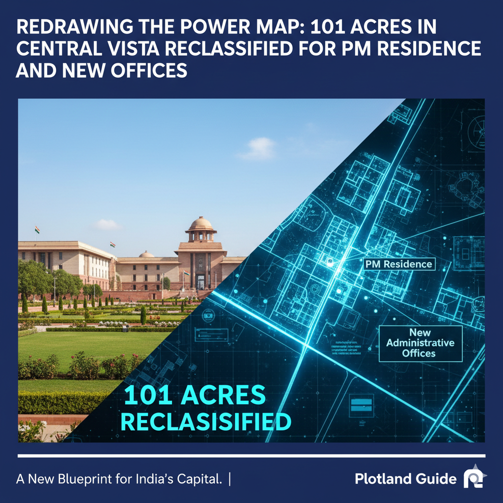
The heart of New Delhi is undergoing its most significant surgical transformation in a century. For years, the Central Vista—the roughly 3-kilometer stretch from Rashtrapati Bhavan to India Gate—has been the subject of intense debate, architectural reimaging, and rapid construction. Now, in a definitive move that cements the new administrative geography of the capital, the government has officially altered the land use for nearly 101 acres of prime real estate in this zone.
In a recent parliamentary submission in February 2026, the Ministry of Housing and Urban Affairs (MoHUA) confirmed that seven key plots, previously designated largely for public, semi-public, and recreational use, have been rezoned. This regulatory shift paves the way for the completion of the new official residences for the Prime Minister and Vice President, alongside the massive Common Central Secretariat (CCS).
For urban planners, real estate analysts, and the citizens of Delhi, this notification is more than just paperwork—it is the final blueprint of a new corridor of power. Here is a comprehensive deep dive into what has changed, where the new enclaves are rising, and what this means for the future of the capital’s most iconic stretch.
The land use changes are precise and strategic, targeting specific pockets of Lutyens’ Delhi to create a consolidated, high-security administrative core. The notification details modifications to seven specific plots, transitioning them from "mixed-use" or "recreational" to dedicated "Government" and "Residential" categories.
Perhaps the most significant change concerns Plot No. 7, a 15-acre parcel located north of Dalhousie Road, near the South Block.
On the opposite side of the axis lies Plot No. 1, a 15-acre site on Church Road near the DTC Central Secretariat bus terminal.
Plot No. 2, measuring 9.5 acres and sitting directly opposite the Parliament House, has also seen a critical shift.
The remaining plots, collectively spanning over 60 acres, form the backbone of the Common Central Secretariat (CCS).
Critics have often questioned the necessity of converting public spaces into restricted government zones. However, the government’s rationale rests on three pillars: Consolidation, Efficiency, and Security.
Currently, central government ministries are scattered across Delhi—from the CGO Complex in Lodhi Road to various rented buildings in the city center. This fragmentation results in massive annual rental bills (estimated at ₹1,000 crore annually) and inefficient inter-ministerial coordination. The land use change allows for the construction of 10 massive CCS buildings that will house all 51 central ministries in a single location.
The redesign creates a compact "power loop." With the PM and VP residences moved directly adjacent to the North and South Blocks, and the ministries clustered along Kartavya Path (formerly Rajpath), the need for vehicular movement is drastically reduced. The vision is a walkable, secure administrative district where files and officials move through underground tunnels or secure corridors rather than clogging Delhi’s arterial roads.
One of the most contentious aspects of the Central Vista project has been the environmental cost. The recent parliamentary reply confirmed that 2,994 trees were either felled or transplanted to accommodate these land use changes.
This statistic has reignited the debate on the loss of Delhi's green cover. However, the government asserts that the master plan is "net-positive" in terms of greenery. The design includes:
The challenge now lies in the execution—ensuring that the transplanted trees survive and that the new saplings mature into the dense canopy that defines Lutyens' Delhi.
While these 101 acres are a restricted government zone, the ripple effects of this rezoning will be felt across the city’s property and infrastructure landscape.
As ministries vacate their current offices in buildings like Krishi Bhawan, Shastri Bhawan, and Nirman Bhawan, massive parcels of land in prime locations will eventually open up. While the immediate plan is to demolish these aging structures, their removal will de-densify the traffic in areas like Connaught Place and ITO, potentially boosting the commercial value of surrounding private real estate due to improved accessibility.
The North and South Blocks—the current seats of the most powerful ministries—are slated to be converted into the National Museum. This land use shift essentially returns the most majestic buildings on Raisina Hill to the public. This transformation will create a world-class cultural district, likely boosting tourism and the hospitality economy in the vicinity of Janpath and Connaught Place.
With the PM and VP movement taken off the main roads, the periodic roadblocks on routes like Tughlaq Road and Akbar Road will vanish. This seamless flow of traffic will be a major relief for daily commuters moving from South Delhi to the Central Business District.
As of early 2026, the physical transformation driven by these land use changes is rapidly materializing. The new Parliament is operational, the Kartavya Path is bustling with tourists, and the steel frames of the Common Central Secretariat buildings are rising fast.
The notification of these 101 acres is the administrative seal on a physical reality. It marks the end of the planning phase and the beginning of the operational phase of the "New India" capital.
For the citizens of Delhi, the Central Vista has always been "the people's place"—a spot for winter picnics and evening drives. While 101 acres of this zone are now officially turning into a fortress of governance, the project promises a trade-off: a more efficient government, a grander public museum district, and a city center that (hopefully) breathes a little easier without the VVIP cavalcades.
As the barricades eventually come down, Delhi will wake up to a city center that looks different, functions differently, and is legally redefined for the next century of the Indian Republic.
