Published On:
February 24, 2026
Updated On:
February 24, 2026
The rapidly expanding Regional Rapid Transit System (RRTS) is set to revolutionize commuting in the National Capital Region, drastically cutting travel times, decongesting major highways, and unlocking massive real estate potential across satellite cities like Sonipat, Panipat, and Karnal.
The National Capital Region has long been an economic powerhouse, drawing millions of professionals, entrepreneurs, and industrial workers to its core cities. For decades, the financial and commercial epicenters of Delhi, Gurugram, and Noida have dictated the pace of regional growth. However, as these traditional urban cores reach a point of severe infrastructural saturation, the geographical footprint of the NCR is inevitably expanding outward. Suburbs and peri-urban hubs are witnessing rapid residential and industrial growth, attempting to absorb the spillover demand from the capital.
Yet, a glaring disconnect remains. While real estate and industrial clusters have moved deeper into neighboring states, transit connectivity has entirely failed to keep pace. For the millions of people living in these satellite towns, accessing the economic opportunities of the central capital requires enduring a daily logistical nightmare. Key corridors, particularly the heavily relied upon NH-44, are plagued by relentless congestion, unpredictable commute times, and severe vehicular pollution. It has become abundantly clear that as the NCR transforms into a massive, multi-nodal urban region, the traditional reliance on private vehicles and overburdened highways is no longer sustainable.
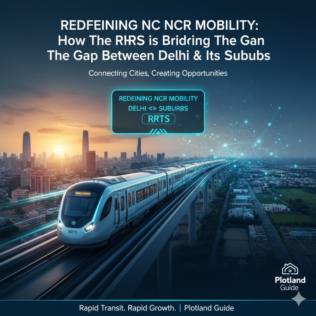
To address this massive mobility deficit, the introduction of the Regional Rapid Transit System (RRTS), officially branded as the Namo Bharat network, represents a watershed moment in Indian urban planning. This ambitious infrastructure project is not just about laying new train tracks; it is about fundamentally redrawing the economic and residential map of northern India, bridging the vast distances between the urban core and the sprawling suburbs.
To grasp the magnitude of the Namo Bharat project, it is essential to understand how it differs from existing public transport options. Many commuters mistakenly equate the RRTS with the Delhi Metro, but their operational philosophies are entirely distinct. Metro systems are meticulously designed for intra-city movement—they feature numerous stops situated very close to one another and operate at moderate speeds to efficiently distribute large volumes of passengers within a dense city grid.
The RRTS, conversely, is heavily tailored for fast, frequent, and highly reliable inter-city commuting across vast regional distances. These semi-high-speed rail networks are engineered to operate at significantly higher maximum speeds, with trainsets capable of reaching up to 160 kilometers per hour. By strategically spacing stations several kilometers apart and utilizing dedicated, elevated, or underground corridors, the system maintains an exceptionally high average speed. This unique design approach makes daily, long-distance travel across state borders not only practical but remarkably time-efficient, effectively shrinking the vast geography of the NCR.
While the initial operational segments of the RRTS heading eastward toward Meerut have already demonstrated the system's capabilities, the upcoming northern corridors are poised to trigger an equally massive regional transformation. The planned Delhi–Panipat–Karnal stretch stands out as a particularly strategic link, designed to seamlessly connect the heart of the national capital with Haryana's rapidly industrializing northern belt.
Stretching approximately 136 kilometers, this expansive corridor will originate from the massive multimodal transit hub at Sarai Kale Khan in Delhi and terminate in Karnal, carving a high-speed path directly through Sonipat and Panipat. The current blueprint outlines a carefully mapped route featuring 17 to 18 key transit stations.
For the real estate markets and industrial sectors situated along this northern spine, the implementation of this corridor is widely viewed as the ultimate growth trigger. It promises to bring multiple residential catchments and heavy industrial zones significantly closer to Delhi's economic core. Commute durations that currently discourage daily travel—often taking several hours each way depending on highway traffic—are set to shrink to a fraction of their current times. Suddenly, destinations such as the bustling highway town of Murthal, the textile hub of Panipat, and even the distant agricultural and commercial center of Karnal will fall squarely within a practical, daily commuting radius of New Delhi.
The ripple effects of such drastic reductions in travel time extend far beyond mere convenience; they act as a massive catalyst for real estate revaluation. For real estate developers, institutional investors, and prospective homebuyers, the Delhi–Panipat–Karnal corridor serves as a perfect case study of how high-speed regional connectivity can unlock entirely new micro-markets.
Historically, professionals working in central Delhi or Gurugram were forced to rent or purchase property within a tightly constrained radius to avoid an exhausting daily drive. This intense, localized demand drove property prices and rental yields in the capital to astronomical heights, pricing out a significant portion of the middle class. The Namo Bharat network aggressively redistributes this demand. By making daily commuting from distant satellite towns highly attractive and stress-free, professionals gain the freedom to access high-paying jobs in urban centers without the necessity of physically relocating to those expensive micro-markets.
This newfound mobility allows families to invest in larger, significantly more affordable homes in emerging suburban clusters, enjoying a superior quality of life, cleaner air, and better social amenities, all while retaining seamless access to the capital. Real estate analysts anticipate a surge in residential project launches across the Sonipat and Panipat belts, specifically targeting this new demographic of long-distance, high-speed commuters.
From an urban planning perspective, the impact of the RRTS will be highly structured and transformative, heavily driven by the principles of Transit-Oriented Development (TOD). The local governments and development authorities are not just building isolated train stations; they are planning massive, self-sustaining urban ecosystems around these transit nodes.
The zones immediately surrounding the upcoming RRTS stations in places like Kundli, Sonipat, and Panipat are expected to witness intense, mixed-use growth. Planners envision vibrant, walkable neighborhoods where premium residential apartments, modern commercial office spaces, retail complexes, and entertainment avenues seamlessly coexist. By clustering high-density development directly around the transit hubs, authorities encourage residents to rely entirely on public transport for their daily needs, drastically reducing the necessity for private car ownership.
This structured approach to growth is expected to aggressively push up land values in the immediate vicinity of the stations. More importantly, it helps create independent, self-sustaining urban clusters beyond Delhi's crowded core. Instead of auto-centric, horizontal urban sprawl that eats into agricultural land and strains municipal resources, the NCR will benefit from highly concentrated, infrastructure-led growth.
Beyond residential real estate, improved mobility is the lifeblood of industrial expansion. The northern NCR belt is already home to significant manufacturing zones, warehousing facilities, and educational institutions. However, recruiting top-tier corporate talent or specialized management professionals to work in these distant hubs has always been a major challenge for local businesses.
The RRTS fundamentally solves this talent acquisition hurdle. With fast, air-conditioned, and reliable trains running every few minutes, a corporate executive living in South Delhi can comfortably commute to an industrial park in Kundli or an educational hub in Sonipat without enduring the physical toll of highway driving. This seamless movement of human capital deepens the economic integration of the entire region. It helps attract long-term corporate investment into these emerging nodes, confident in the knowledge that they can easily tap into the capital's vast talent pool. As a result, commercial real estate—including premium office spaces, corporate parks, and high-tech warehousing—is expected to see a massive boom along the corridor.
The benefits of the Namo Bharat network extend far beyond market dynamics and real estate appreciation; it carries profound environmental and social implications for a region perpetually grappling with an ecological crisis. The National Capital Region frequently battles some of the worst air quality indices in the world, a situation severely exacerbated by the sheer volume of fossil-fuel-dependent private vehicles idling in daily traffic jams.
By offering a high-speed, dependable, and highly comfortable alternative to road travel, the transit system is specifically designed to trigger a massive modal shift. The goal is to move hundreds of thousands of daily commuters out of their private cars and off congested highways like NH-44. Operating on clean electric power, the trains themselves produce zero direct emissions.
At a critical juncture when air quality and environmental sustainability remain persistent, year-round concerns, this large-scale transition toward high-capacity public transport will play an absolutely vital role in reducing the NCR's overall carbon footprint. Furthermore, it delivers a more equitable commuting experience. The modern trainsets, equipped with premium seating, dedicated women's coaches, and onboard amenities, ensure that fast, safe, and comfortable travel is accessible to a much broader segment of the population.
When viewing the broader picture, the Regional Rapid Transit System represents far more than just another layer of concrete and steel infrastructure. It signals a fundamental, necessary shift in how the National Capital Region will grow and evolve over the next century.
For decades, the standard model of growth relied on forcing people to move closer to the center, resulting in cramped living conditions and strained urban resources. The Namo Bharat network flips that narrative entirely. It proves that a region can grow outward sustainably by narrowing the temporal distance between cities and their surrounding towns. It disperses economic opportunity evenly across the map and enables people to live farther away from traditional urban cores without ever sacrificing access to jobs, healthcare, or entertainment.
As the construction of the northern corridors accelerates and the stations take shape, the RRTS stands ready to redefine the daily mobility of millions. In the process, it will successfully bridge the long-standing gaps between the urban and the suburban, cementing a deeply interconnected, balanced, and highly efficient future for the entire National Capital Region.
