Published On:
January 27, 2026
Updated On:
February 11, 2026
The Gurugram Metropolitan Development Authority (GMDA) has unveiled a groundbreaking integrated mobility plan, combining metro lines and elevated roads on the same corridors to permanently decongest Old Gurugram and preserve critical right-of-way.
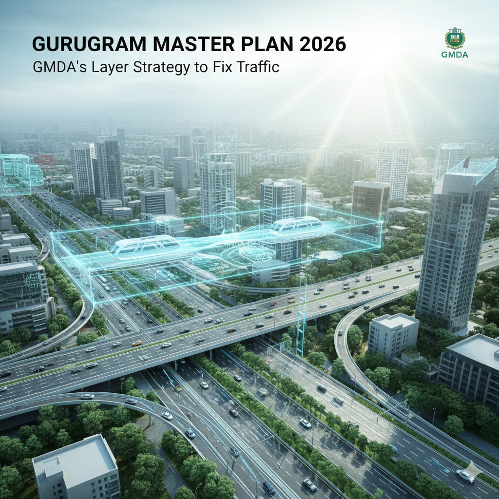
For years, the infrastructure narrative in Gurugram has been a tale of two cities: the rapid, glossy expansion of "New Gurugram" and the congested, gridlocked reality of "Old Gurugram." That narrative is set for a decisive rewrite. In a strategic pivot that moves away from piecemeal solutions, the Gurugram Metropolitan Development Authority (GMDA) has mandated a unified planning approach for future metro corridors and elevated roads.
This isn't just about building more roads; it is about "vertical urbanism." The authority has directed agencies to plan metro lines and flyovers simultaneously along the same alignments, ensuring that the city maximizes its limited space while solving its most chronic traffic bottlenecks.
Historically, road networks and mass transit systems in Indian cities have been planned in isolation. One agency builds a flyover, and five years later, a metro corporation realizes the same stretch needs a rail line, leading to demolition, land acquisition hurdles, and endless construction chaos.
The GMDA’s latest directive effectively ends this siloed approach. By bringing the Gurugram Metro Rail Limited (GMRL) and the Haryana Mass Rapid Transport Corporation (HMRTC) to the same table, the city is moving toward a "multi-modal corridor" concept. The immediate focus is on preserving the Right of Way (ROW). In dense urban pockets where expanding the road width horizontally is impossible, the only way is up. This integrated plan envisions a multi-level transport system where surface roads cater to local traffic, elevated roads handle through-traffic, and metro lines transport mass commuters—all stacked within the same geographic footprint.
The testing ground for this ambitious strategy is the Old Railway Road, a stretch infamous for its peak-hour paralysis. The GMDA is exploring the feasibility of constructing an elevated road that runs parallel to—or integrated with—the proposed metro corridor.
The plan involves a 7.4-kilometer elevated road starting from Rajiv Chowk, looping near the Sector 5 junction, and terminating near Atul Kataria Chowk. This is critical because this specific corridor overlaps with the upcoming Gurugram Railway Station to Bhondsi metro line. Without integrated planning, constructing one would effectively block the other.
Engineers are now tasked with a complex challenge: fitting a four-lane flyover and a metro viaduct in a constrained urban artery. If successful, this dual-deck structure could serve as a model for other high-density Indian cities, proving that mass transit and private vehicle infrastructure can co-exist without cannibalizing each other’s space.
Beyond just traffic relief, this integration brings operational efficiency to the metro network itself. The planning covers two major lifelines: the Millennium City Centre to Cyber City loop and the aforementioned Railway Station to Bhondsi corridor.
A key highlight of this unified approach is the decision to have both corridors share a common depot in Sector 33. This is a masterstroke in land optimization. Instead of acquiring separate diverse land parcels for maintenance yards—a costly and time-consuming process—the integrated approach allows for shared resources, reducing both capital expenditure and execution timelines.
For the residents of Old Gurugram, particularly in sectors along the Old Delhi-Gurgaon Road and near the Railway Station, this is the most significant infrastructure promise in decades. It signals that the administration is finally addressing the "infrastructure deficit" in the older parts of the city.
For real estate investors, this development changes the map. Properties along these dual-mobility corridors are likely to see a re-rating. Connectivity is the primary driver of capital appreciation, and a location served by both a rapid metro and a signal-free elevated road offers the highest level of accessibility.
While the vision is sound, the execution will require engineering precision. The primary hurdle remains the narrow width of existing roads in Old Gurugram. However, by freezing the alignment now and ensuring that neither the road nor the metro "blocks" the future path of the other, GMDA is future-proofing the city.
This initiative marks a maturity in Gurugram’s urban planning. It acknowledges that congestion cannot be solved by roads alone, nor by metro alone, but by a synchronized dance of both.
