Published On:
June 22, 2026
Updated On:
June 22, 2026
The recently cleared NCR Regional Plan 2041 outlines a transformative blueprint for North India, featuring the development of four new semi-greenfield cities, expansive expressway networks, and strengthened environmental regulations to ensure sustainable, decentralized urban growth across a 55,000 square kilometer area.
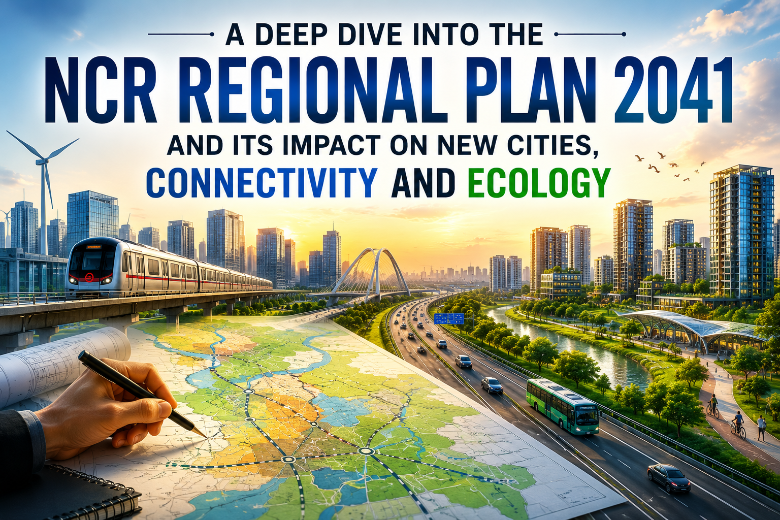
For decades, the National Capital Region has stood as the undisputed economic powerhouse of North India. However, the relentless influx of people, businesses, and industrial activity has placed extraordinary pressure on the existing infrastructure of Delhi and its immediate satellite towns. Recognising the urgent need for a decentralized, sustainable, and forward-looking urban strategy, planning authorities have recently cleared the highly anticipated NCR Regional Plan 2041. After years of meticulous drafting and extensive consultations across multiple state governments, this comprehensive policy document has been formulated to dictate land use, infrastructure creation, environmental conservation, and mobility across an expansive 55,000 square kilometers for the next two decades.
This is not merely a localized development strategy for the capital. It is a multi-state blueprint encompassing Delhi, fourteen districts in Haryana, eight districts in Uttar Pradesh, and two districts in Rajasthan. The overarching vision is to seamlessly integrate this vast geography, shifting the focus from a singular urban core to a vibrant, multi-nodal regional economy. Understanding the intricate details of the NCR Regional Plan 2041 is essential for urban planners, real estate investors, and millions of residents whose daily lives will be profoundly reshaped by its implementation.
The primary catalyst behind the drafting of this ambitious regional plan is the staggering demographic shift projected over the coming decades. Current estimates suggest that the population within the National Capital Region will witness a massive surge, potentially reaching 11 crore to over 14 crore residents by the year 2041. Accompanying this sheer population growth is a rapid acceleration in urbanization, with urban dwellers expected to account for a massive sixty-seven percent of the region's total demographic profile by the end of the plan's horizon.
Accommodating tens of millions of new residents within the existing urban footprint of Delhi, Gurugram, or Noida is a logistical impossibility. The existing civic amenities, housing markets, and transport networks are already stretched to their absolute limits. The Regional Plan 2041 addresses this demographic challenge by aggressively promoting balanced regional growth. Instead of allowing unplanned, haphazard urban sprawl to consume agricultural lands on the peripheries of existing cities, the framework establishes strict guidelines for creating entirely new urban centers equipped with high-quality residential zones, healthcare facilities, and digital infrastructure. The strategy relies on dispersing employment generation across the broader region, ensuring that jobs, housing, and social infrastructure are equitably distributed.
One of the most defining and headline-generating features of the approved master plan is the strategic decision to develop four entirely new greenfield and semi-greenfield urban centers. These proposed urban nodes have been designated as Namo Cities. To ensure equitable development and shared economic prosperity, these four cities will be distributed equally across the participating states, with one city planned for Delhi, Haryana, Uttar Pradesh, and Rajasthan respectively.
The development model for these new cities represents a significant departure from traditional urban expansion. A dedicated allocation of five thousand crore rupees has been earmarked over the next five years to kickstart their foundational infrastructure. These urban centers will be built on the principles of Transit-Oriented Development, meaning their geographical layout and commercial density will be heavily integrated with high-speed mass transit networks. Specifically, these new hubs are slated to be positioned along the upcoming Regional Rapid Transit System (RRTS) corridors.
The goal is to create highly localized, self-sustaining micro-economies. Residents of these new centers will have access to local employment hubs, robust civic infrastructure, and commercial districts right at their doorstep, drastically reducing their reliance on the central capital for daily professional and social needs. By rationalizing floor area ratios and floor space indexes around these transit corridors, authorities aim to unlock massive high-density housing and commercial supply, establishing these areas as prime destinations for future real estate investment.
Mobility is the lifeblood of any regional economy, and the NCR Regional Plan 2041 places an unprecedented emphasis on transforming how people and freight move across state borders. The blueprint envisions a highly integrated transport network where multiple modes of transit—from rapid rail to vast road networks—operate in complete synergy. The ultimate objective is the realization of a thirty-minute region, an ambitious concept where the majority of essential services, major employment hubs, and residential zones are accessible within a half-hour transit window.
To achieve this, the plan outlines the construction of two massive regional expressways that will fundamentally alter the logistics and commuting map of North India. The first proposed expressway will create a high-speed corridor linking Panipat, Meerut, Hapur, Rewari, and Rohtak. The second major roadway will connect Karnal, Muzaffarnagar, Aligarh, Mathura, and Alwar. These expansive road networks are designed to bypass the congested core of Delhi entirely, allowing heavy freight and inter-state commuters to traverse the region efficiently.
Complementing these road projects is the approval of an orbital railway network in Uttar Pradesh, mirroring a similar project already greenlit for Haryana. The core region itself will be strictly defined and bounded by the existing Kundli-Ghaziabad-Palwal and Kundli-Manesar-Palwal expressway networks. Beyond just reducing travel times, these new transport corridors are expected to give rise to entirely new economic zones. Industrial parks, warehousing clusters, and commercial districts will naturally emerge along these expressways, driving land value appreciation and opening up previously inaccessible rural hinterlands to organized real estate development.
While expanding road networks is crucial for economic growth, authorities are acutely aware of the severe air quality crisis that plagues the National Capital Region every winter. Vehicular emissions constitute a massive portion of the region's overall pollution load, specifically the exhaust from heavy commercial trucks and older transit buses that cross state borders daily.
To directly combat this environmental hazard, the regional plan incorporates a dedicated vehicle modernization scheme known as PARIVARTAN, which stands for the Program for Accelerated Renewal and Incentivization of Vehicle Assets for Reducing Transport Air-Pollution and Network Emission. This policy framework is designed to forcefully phase out aging, highly polluting commercial vehicles that still operate on obsolete emission standards. The initiative will heavily promote and mandate the replacement of older commercial trucks and buses with modern fleets compliant with stringent BS-VI standards, as well as an aggressive pivot toward compressed natural gas and fully electric mobility solutions. By overhauling the commercial fleet, the plan aims to significantly improve ambient air quality, making the region a healthier environment for its rapidly growing population.
Perhaps the most scrutinized and debated aspect of the NCR Regional Plan 2041 involves its environmental regulations and land-use zoning. The region is highly vulnerable to the impacts of climate change, struggling with severe water stress, depleting groundwater tables, and the constant threat of desertification from the advancing Thar desert.
The Aravalli hill range serves as the critical green lung and the solitary natural barrier protecting Delhi, South Haryana, and surrounding cities from intense sandstorms. These ancient hills, characterized by deep natural fissures, also act as an indispensable groundwater recharge zone capable of absorbing millions of liters of water per hectare annually. Ensuring the absolute protection of the Aravalli ecosystem has been a central point of contention and focus for environmental advocates. The regional blueprint aims to solidify conservation efforts by meticulously demarcating natural conservation zones and strictly regulating mining, real estate encroachment, and unauthorized construction within these ecologically sensitive boundaries.
Beyond simply restricting development in protected zones, the plan introduces highly innovative mechanisms to actively increase the region's green canopy. State governments will be heavily incentivized to expand forest cover and preserve green belts through the introduction of green canopy credits and transferable Special Development Rights. These non-financial tools will allow authorities and private developers to balance urban expansion with ecological preservation. Furthermore, the plan places a heavy mandate on wastewater recycling capabilities and widespread rainwater harvesting infrastructure to secure the region's fragile water future.
The notification and implementation of the Regional Plan 2041 will send massive ripples through the real estate and commercial sectors. By providing absolute clarity on land use, infrastructure timelines, and zoning regulations, the document acts as a highly reliable map for institutional investors and real estate developers looking to deploy capital over the next twenty years.
The development of new expressways, the operationalization of transit networks like the RRTS, and the creation of the four new cities will unlock tremendous real estate value in emerging corridors. Regions such as the Gurugram-Manesar belt, the Sonipat growth cluster, the Panipat corridor, and the Rewari logistics zones are expected to witness a massive influx of investment. Similarly, areas in Uttar Pradesh, particularly around the rapidly developing Jewar aviation hub and Meerut, will see exponential demand for both residential housing and commercial office space.
The clear demarcation of development zones means that investments can be made with high confidence, minimizing the regulatory risks associated with unapproved land use changes. The plan promotes infrastructure-led appreciation, where property values rise proportionally with the completion of road networks and civic amenities. As global capability centers, multinational corporations, and large-scale manufacturing units look to establish a presence in North India, the designated economic corridors mapped out in this plan will serve as their primary destinations, creating thousands of jobs and driving a sustained demand for premium residential real estate.
To prevent the chaotic sprawl that has characterized earlier phases of urban growth, the new framework implements a highly structured, tiered approach to regional development. The entire area will be categorized into distinct policy zones based on their proximity to the urban core and the major orbital expressways.
Development restrictions, floor area ratios, and land use permissions will be carefully calibrated depending on whether a sector falls within the immediate urban periphery, a highway corridor, or a designated natural conservation zone. This methodical zoning ensures that industrial heavyweights and polluting industries are pushed further away from dense residential settlements and ecologically fragile areas. It also addresses the complex issue of managing existing unauthorized colonies and unplanned settlements, particularly those situated in highly sensitive zones like the Yamuna floodplains. By setting firm boundaries and establishing clear guidelines for land pooling, transit-oriented development, and the regeneration of planned spaces, the blueprint aims to retroactively organize chaotic urban pockets while tightly controlling all future expansions.
The NCR Regional Plan 2041 is a monumental policy document that fundamentally reimagines the trajectory of North India's urban evolution. It acknowledges the stark reality that the current model of hyper-concentrated growth within a single capital city is entirely unsustainable. By aggressively pushing for decentralization, mandating strict environmental safeguards, and prioritizing high-speed regional connectivity, the plan lays down a highly pragmatic roadmap for the future.
The successful development of the proposed new urban centers, the timely execution of the massive expressway networks, and the unwavering protection of the Aravalli hills will dictate the quality of life for millions of people. As this ambitious blueprint moves from the planning tables to active implementation, it promises to transform the National Capital Region from a congested, heavily burdened metropolis into a cohesive, highly livable, and globally competitive economic territory.
